
How to generate a fantasy continent
Loremapper's generator builds a continent the way land forms: mountain ranges in belts, rivers that drain real basins to the sea, climate that follows the wind. This guide takes about five minutes and needs no account.
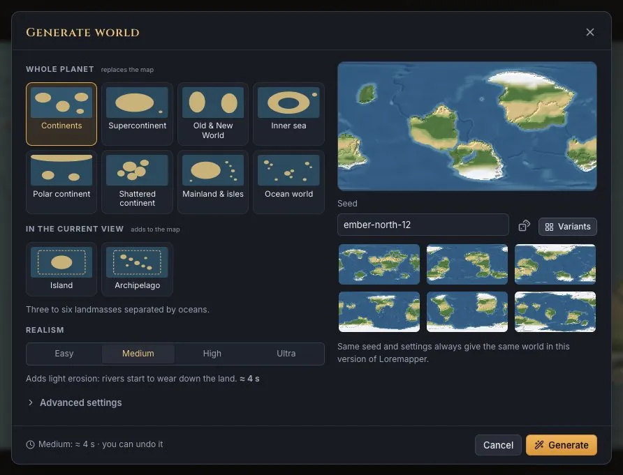
Steps
- Create a map of the right size. Open the editor and make a new map: a flat map from 250 km (a region) to 10,000 km (a continent or more), or a whole planet. The size is real: a mountain range will be 100–200 km wide on any map.
- Open Generate and pick a shape. Press Generate in the top bar. Small flat maps offer shapes such as Part of a continent, Coast, Peninsula, Inland, Island, Island and islets, Archipelago, Inner sea or Meteorite crater; big maps and planets offer whole-world layouts such as Continents or Supercontinent.
- Choose the climate and realism. Pick a climate from Tropical to Polar. Realism (Easy to Ultra) sets how long the river network is allowed to settle: higher levels give longer rivers and cleaner valleys and take a few seconds more.
- Fine-tune in Advanced settings. Open Advanced settings to set how much of the land mountains and ranges cover, how hilly the land between them is, and on flat maps the prevailing wind: where it blows from, how strong, moist and warm it is. Slopes facing the wind are wet; the land behind a range lies in its rain shadow.
- Use a seed, or try variants. A seed such as amber-drake-7 always gives the same world with the same settings. Press the dice for a new one, or Variants to see several worlds side by side and pick one.
- Generate, then make it yours. Press Generate. Anything can be undone. Then edit: drag the generated mountain ranges, raise or lower land with brushes, add rivers, paint biomes, and name lands and seas in the Lands & seas panel (Write name on map puts the name on the map).
Tips for a believable result
- Match the size to the story: a kingdom is a few hundred kilometres across; a continent several thousand.
- Keep the default middle settings first — they are Earth-like — and change one thing at a time.
- Check the relief in the height view (Height in the top bar): every point has an elevation in metres.
- For a planet, the map wraps around east to west; for a region, the land runs on past the edges like part of a bigger continent.
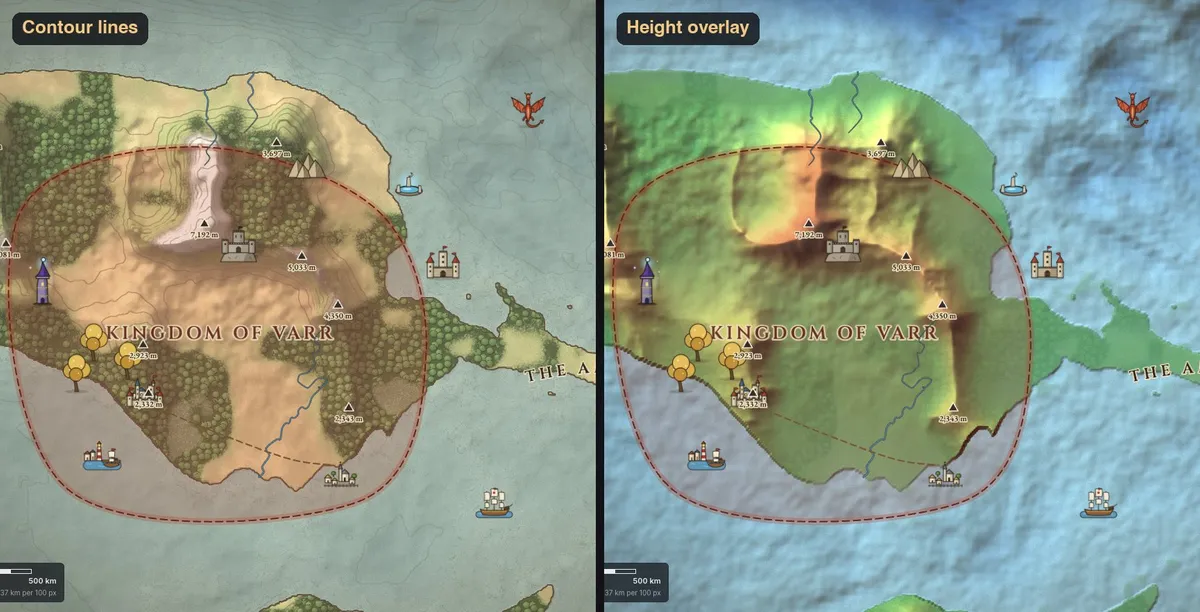
Next
Read how to make a fantasy map for the design side, make a player map with fog of war, or export a heightmap for a game engine. Or just open the editor.